We may earn money or products from the companies mentioned in this post.
Note: This is part 8 of a continuing series (currently up to 13 entries). I’m making an old post public each time I make a new one for patrons (so when Part 14 goes up, Part 9 will go public). If you don’t want to wait, become a patron! You can find out more about Khezvaros, The City of Ten Thousand Daggers, at World Anvil.
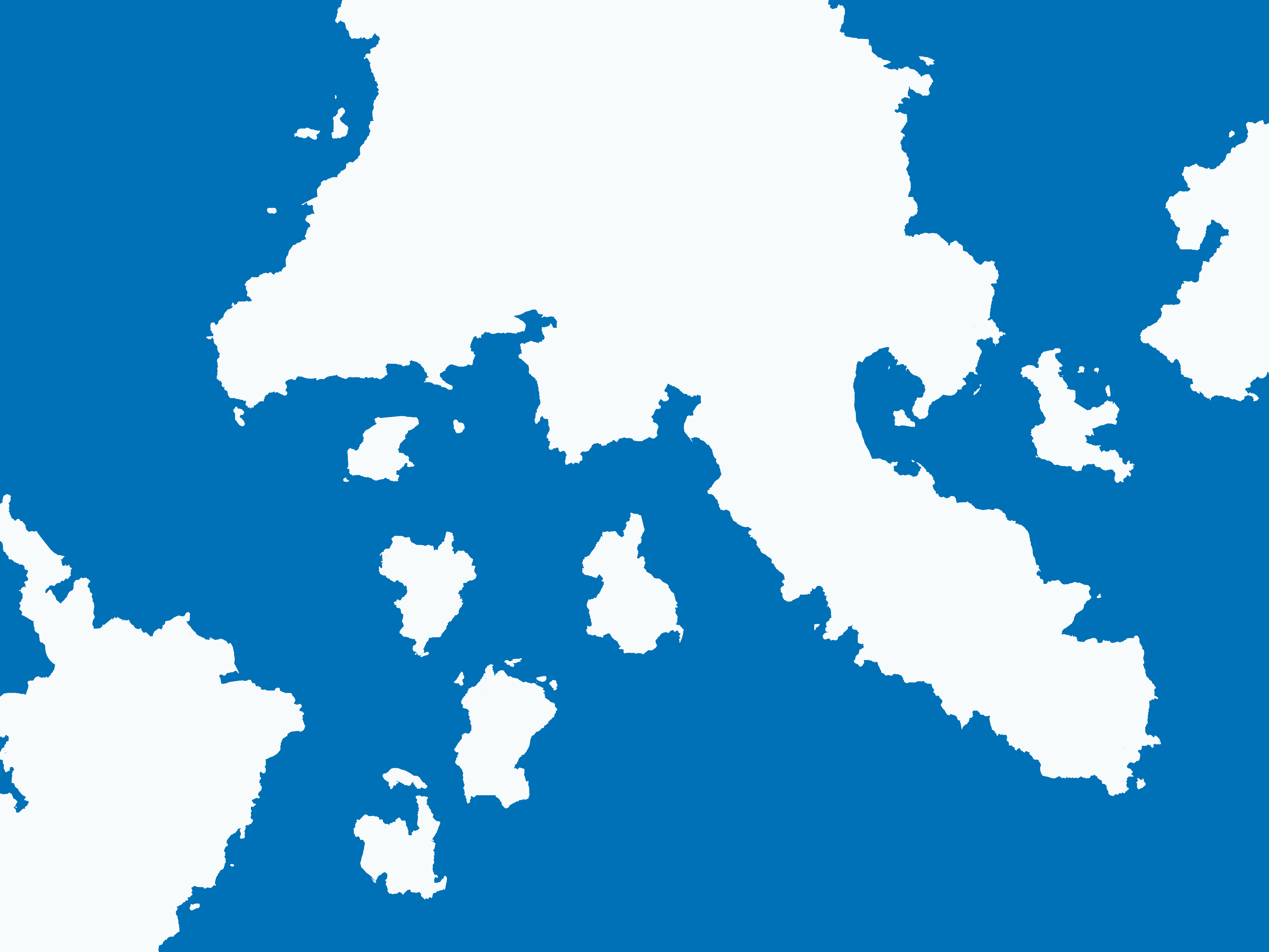
After quite some time (I’ve got 92 layers of coastline in my landmass folder), I get all my coastlines blocked out:
Here’s a copy with a semi-transparent version of the template on top so you can get a better idea of where I stuck closely to the original and where I got lazy.
The next step is to clean this up, but since that involves merging things I’m going to save the file under a new file name just in case I need to get back to the layered version. Once I’ve done that, I merge all the layers in my landmass folder, use the fill tool to change them from black to white, and put a fairly thick stroke (10px) around the land layer. This will make it obvious where there are holes in the joins, stray pixels, and other artifacts that need to be cleaned up.

Now I zoom in and go around the map with my paintbrush and eraser cleaning up the ugly bits and painting in the center of the continents.

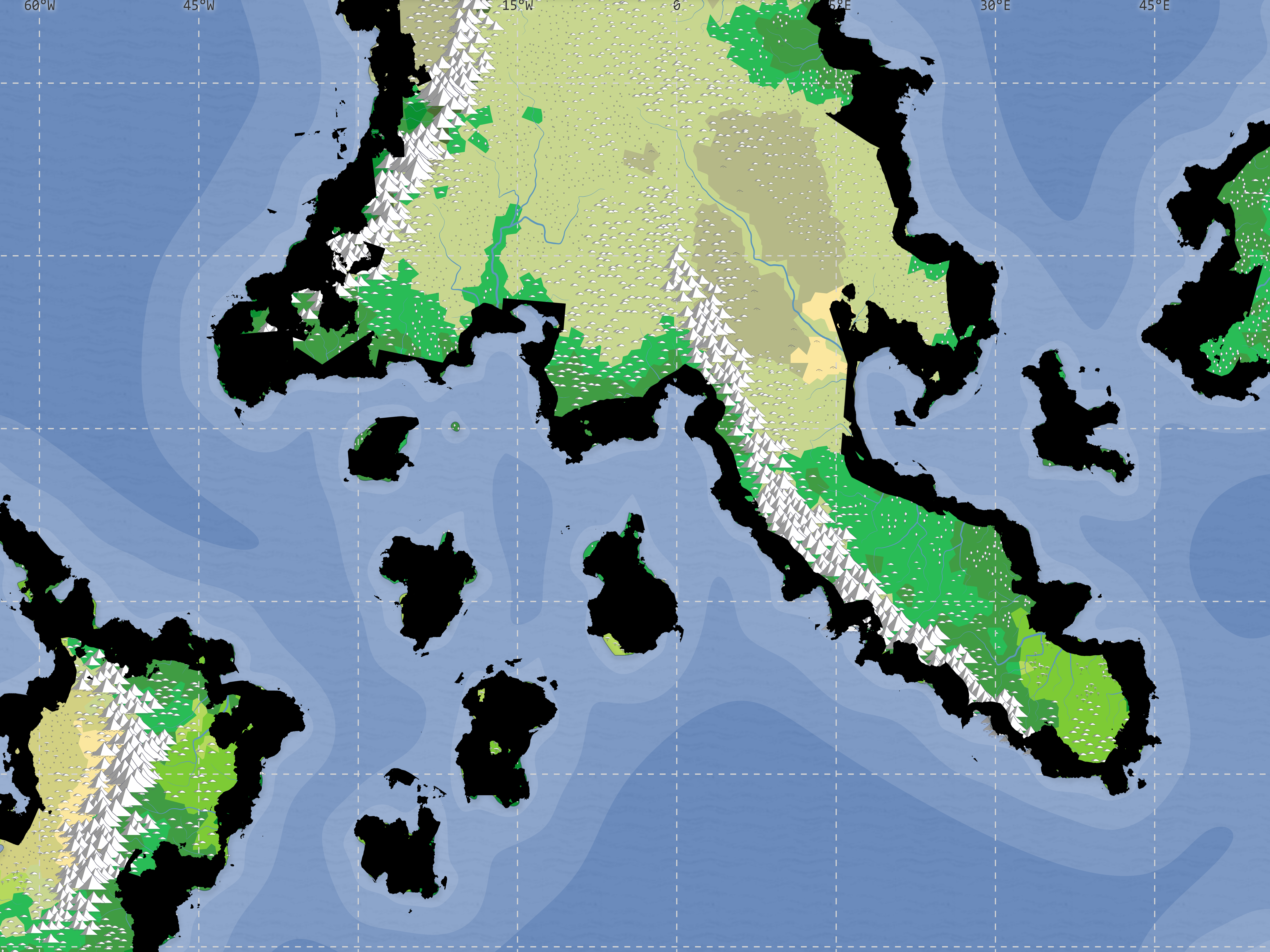
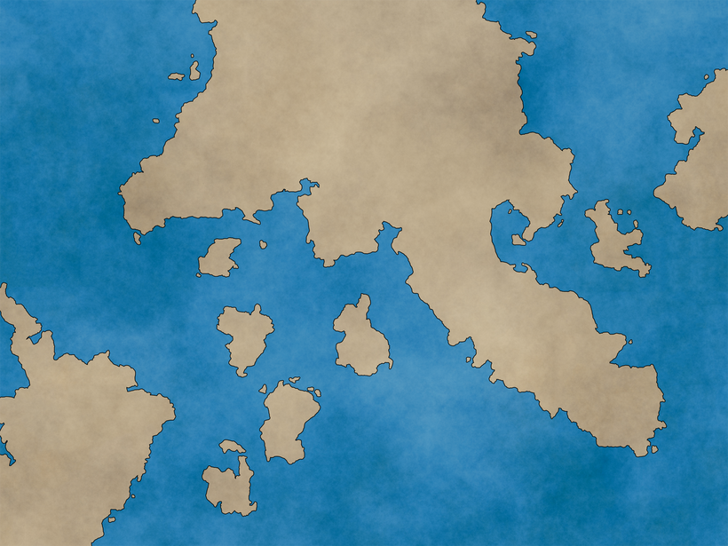
This basically gets me back to the “Add Landmass” step of our old pal Jorm’s guidelines. When I turn off the stroke and template layer and turn my water layer back on, I’ve got a map similar to the one he’s using in his tutorial:
Now I need to follow Jorm’s “clean up the landmass” instructions, which is basically the same thing I just did, but with a higher zoom level and a much smaller brush. If you’re doing this at home, you’re going to be tempted to cover a lot of coastline with each “brush stroke.” Don’t do that. It will just give you more that you’ll have to redo if you mess up and have to CTRL+Z something. Let go of the mouse button occasionally so that you’re starting new lines regularly (and yes, I remembered this when I screwed something up).
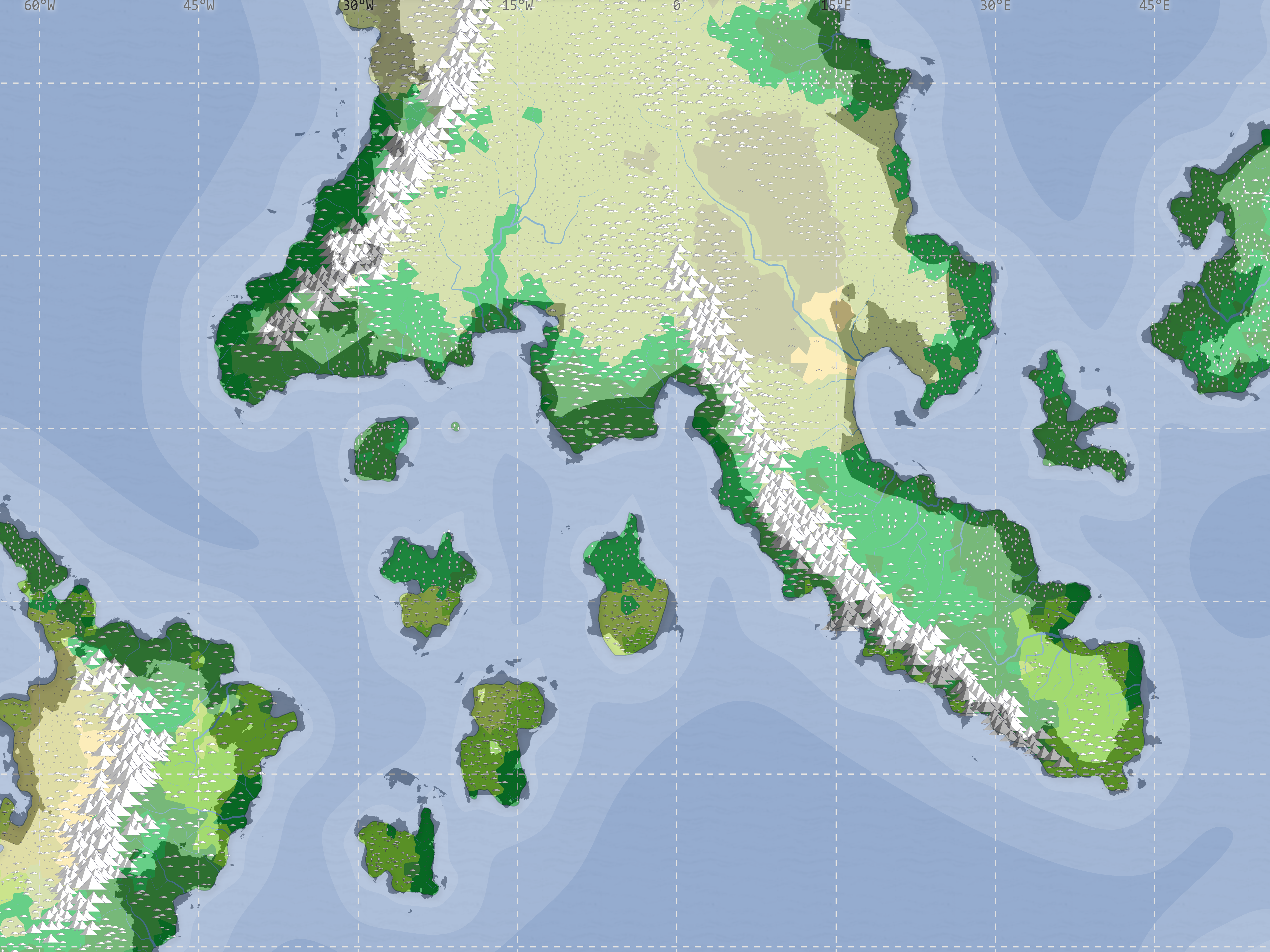
Once I’ve cleaned things up, I continue to follow Jorm’s guidelines, but with a few exceptions:
- I’m using an older version of Photoshop (because Adobe doesn’t sell software anymore and I don’t make enough writing shark and hobo games to justify a $600+ per year membership), and from what I can tell it doesn’t allow multiple strokes on a layer. I think I can fake Jorm’s land styling, but it requires having multiple land layers. Since that means I’d have to match any land change–including when I “draw” the rivers by erasing land–I don’t want to do that just yet. I may come back through and add the cool lines around land at the end, but for now I’m sticking with just a 5px stroke.
- I use a lower opacity for the pattern overlays. Using 100% caused problems with some texturing and wash effects on the Khezvaros city map, so I go with 50%. I go with a lower opacity on the water layer as well, but mainly because I just don’t care for the way it looks at 100%.
In the end, my map looks like this:
Next time, I’ll add rivers, and maybe some other landmarks.