We may earn money or products from the companies mentioned in this post.
Note: This is part 1 of a continuing series (currently on part 6 for patrons). From here on out, I’ll be making an old post public each time I make a new one for patrons (so when Part 7 goes up, Part 2 will go public). If you don’t want to wait, become a patron!
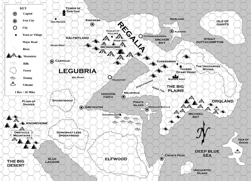
Originally, I hadn’t planned to do any world-building for City of 10,000 Daggers beyond the city itself, but as I’ve added more to the setting I’ve realized that in order to create a cosmopolitan city, you’ve got to know what polises are doing all the cosmoing. Because of the way my brain works, that means I need a world map. Since I’ve been very lax on posting Patron-only content lately (sorry, I suck), I decided to document the process here. If it works out, it might actually be useful. If it ends in disaster, hopefully it will at least be entertaining.
Before I start the actual mapping, I need to figure out what I know about the world. I should probably go back and read through relevant sections of the World Anvil page, but I’m lazy so I’m just going to assume that anything I can’t remember is minor enough that I can change it if I get the map done and notice an inconsistency. So, what do I know about the world? Let’s start with the city itself:

- My main inspirations for the city so far have been Rome, Byzantium (aka Constantinople aka Istanbul; They Might Be Giants left one out), Sanctuary (from Thieves’ World), and Lankhmar, so I’ve been assuming a Mediterranean-ish climate (which fits with at least 3 of those; Lankhmar seems a bit more temperate), but with maybe a slightly more variation between seasons. Winters can get chilly, but actual snowfall is a once in a generation kind of thing.
- A few entries have established that Khezvaros is at the southern end of a large plain where some ancient civilization once stood. It was destroyed in some catastrophe big enough to bury the city underneath Khezvaros. In “modern” times (Khezvaros was founded something like 2000 years ago), these plains supported large herds hunted by the horse lords and other nomads.
- At least the coast where Khezvaros is located is hilly, so (combining with the Mediterranean thing), I’ve been picturing the coast as vaguely like Greece, or at least Greece as drawn by Frank Miller–lots of cliffs and rocky hills and scrubby, stunted trees.
- I know from the map that two small rivers run through town. A third, larger river–most likely the only one big enough to appear on the world map–runs along the eastern side of Khezvaros.
- To the west are more plains (specifically the section of plains where the Horse Lords live), and even farther west is a big forest.
- There are islands to the south (one of which is the ancestral home of the Minotaur family).
- The capital of the empire is 1,000 miles away to the east (though I’m not sure how literal the 1,000 number is).
- South of the empire, there’s a source for coffee. There’s another source for coffee somewhere that makes Khezvaros the logical port for getting it back to the empire, so probably to the southwest, assuming there’s no good sea route back to the capital. Google tells me that coffee grows at high altitudes in tropical rainforests along the equator.
That gives me some vague ideas about what’s in the world, but since I want the world to at least seem realistic I need to deal with the thing that I always hate about world maps: climate. When I did the World of Shymeria map, I didn’t worry a lot about it because it’s a science fantasy cartoon world and I wasn’t too worried about realism.

Before that was Qerth, where the main challenge was making sure that at least part of the word “Kallisti” in Greek letters was readable in the landscape.
When I drew the map for Kreos (my D&D game from college), I basically drew Europe with a few changes and assumed everything was more or less like Europe. Since Kreos was more-or-less-Europe, that worked.

Special thanks to Bill Alexander for teaching me the secrets of the Mighty Palette Knife!
Since I don’t want to just draw Europe again (if only because I know it’ll cause me to take the lazy way out and just populate the world with pseudo-European cultures), I need to figure out how to come up with realistic-seeming weather and landforms and such. I’m a resourceful man with an internet connection, so how hard could it be?
I figured I’d start by drawing the map, so I went to the website I’d used as my main guide for the Khezvaros city map to see what he had to say about world maps. Following the instructions there (which I’d also used for the basic landform of the Khezvaros map), I came up with a basic landform and added some mountains, which some preliminary Googling had told me were important to figuring out climate.

So the plan here was to use something called the Climate Cookbook, which is apparently such a venerable piece of internet gaming lore that it only exists via the Wayback Machine (which means the image links are broken). Luckily, there are tons of examples/retreads on how to use it, like this one. There are some more thorough ones at The Cartographer’s Guild forums, but their site is apparently down right now and I didn’t bookmark the exact link.
I made it through the currents and pressure fronts parts, but had no idea if I was doing them right and my eyes were starting to glaze over. I couldn’t grok how to do the winds, so this version of the map ended here:

Ok, so that was a waste of time. What next? After some searching around, I found this site, which says it will figure out climates based on a bump map. After figuring out what a bump map was, I spent a lot less time making a rough map with black seas and increasingly lighter shades of gray for higher elevations:

When I loaded them up, the results were less than spectacular. This may be due to me not doing the bump map correctly, but in any case is was back to the drawing board.

Several Google searches pointed me to Azgaar’s Fantasy Map Generator. I recognized it as I site I’d seen before and written off as “not what I’m looking for,” mainly because the default map is basically a pre-generated world political map. This time around, I actually looked at the settings and found that there are way more options. I switched to biome view and started randomly generating maps, but none of them really worked. Some looked like they would work, but the land was in the wrong place (usually too far south), and the only way to fix it is to do less than a full world map and adjust the latitude. Since I wanted a full world map (at least to start), I needed the program to use a different algorithm than the ones that were pre-loaded.
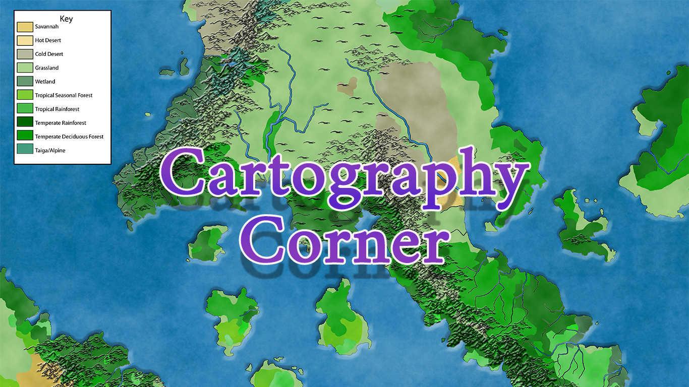
After reading the help page, I found out that you can make up your own set of instructions (called a template) for the program to use when generating maps, and that it’s pretty easy to do. After a little experimenting, I got one that put the land more or less where I wanted it. The file is attached if anyone wants to try it. Go to Tools–>Heightmap, choose “Erase” on the pop-up, click “Template Editor,” upload the file, and hit the little play button to randomly create a map using my pre-sets. After a few random maps (and tweaking a few things in the program’s editor (also accessible via the Height Map section), I ended up with this:

This is a good starting point. The continent on the left has a big area of grassland with a river running through it and forest to the west, there’s another major river on the opposite side of the continent (where the empire can be placed), and there are some tropical rainforests to the south of both of those where coffee can grow if adding mountains doesn’t break the map.
My next step will be to tweak things in photoshop: The southern continent might move to the other side of the map (more Khezvaros-adjacent coffee-growing areas) and I might make the two unused continents smaller and put them farther away from the main one (you don’t want Shangri-Thul too close, after all). Then I’ll load the image back into Fantasy Map Generator to see how my changes affect the climate. Then I’ll start adding mountains and try to move the forest a little farther from the mouth of the river where Khezvaros will be located.
Fantasy Map Generator has its own file format, but you can upload an image file and it will do what the first program does, only much better. When I uploaded the file above into it, the result was close to the original version I’d downloaded. I’ve also played around a bit with tweaking the climates (changing the height of land seems to move things around, and I’m starting to get at least a vague idea of how raising or lowering one thing changes the weather in other parts of the world). I’ll tell you how that goes next time around.