We may earn money or products from the companies mentioned in this post.
Note: This is part 2 of a continuing series (currently on part 7 for patrons). I’m making an old post public each time I make a new one for patrons (so when Part 8 goes up, Part 3 will go public). If you don’t want to wait, become a patron! You can find out more about Khezvaros, The City of Ten Thousand Daggers, at World Anvil.
Last time around, I came up with a map using Azgaar’s Fantasy Map Generator that seemed like a reasonable starting point for my Khezvaros world map. Here’s what it looked like:

The first thing I realize when I load it up in Photoshop is that the ice is going to be a problem if I start moving continents around. Fortunately, Azgaar has a solution. Since the ice is a separate layer, I can just load my .map file back into Fantasy Map Generator, turn off the ice layer, and save a new .png file without all that pesky ice. The resulting map is slightly different from the one above, presumably because I saved the .png file above after some editing but forgot to save the .map file again. It’s still close enough to use a starting point, though.
Once I’ve got the ice-less file, I open it up in Photoshop and prepare to shuffle around continents. I start by creating a base layer and using the fill tool to make it the same color as the base ocean color. Next, I use the lasso to go around the contours of the first continent. Then a copy the selection and paste it as a new layer. I do the same for the other two continents, then for the islands in the lower left corner. When I turn off the original layer, I’m left with a sea layer and 4 land layers that I can move around, resize, and otherwise play with.
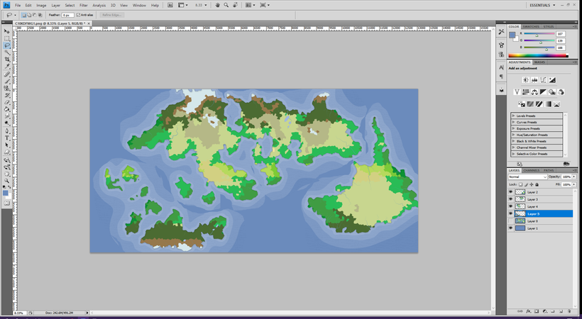
Before I start moving things around, I need to decide whether this is a map of the whole world. Does it “wrap around” at the right and left edge like a Pac-Man game, so the big continent in the lower left is near the island in the lower right? Assuming it’s an earth-sized planet (which I’ve been assuming), it can’t be. If I use the ruler tool to get the distance between Khezvaros and where I plan to put the empire (which is around 1,000 miles) and divide it into the total width of the image, it comes to around 6, which means the map shows about 6,000 miles. According to this site, Earth’s circumference is just over 19,000 miles at the 40 degrees latitude (which is the latitude of Athens, Greece and more or less where Khezvaros is on my map). If the planet is earth-sized, this map has to be partial, since it only shows about 1/3 of the total circumference (less at the equator, where earth is nearly 25,000 around).
Speaking of latitude, I decide those might be handy to know, so I divide the height of my image by 6 and add five guide lines to represent the equator and the 30 and 60 degrees of latitudes, which are close enough for my purposes for getting a rough idea of where the different broad temperature zones are. The tropics extend to 23.5 (Earth’s tilt) degrees north and south of the equator and the polar regions (arctic and antarctic circles in our world) are 23.5 degrees from the poles. Between those are the temperate zones.
This not being a full planet map means I can run things off one edge of the map without having to worry about matching them up on the other side. It also means I don’t have to try to figure out projections or something to deal with there the land than runs off the bottom and top edges reappears somewhere on the same edge. In theory the stuff off the map could change currents and winds in a way that changes the climate in the visible parts of the map, but since the map itself is just background and flavor for the city where in City of 10,000 Dagger game will take place, I’m ok with that. Ideally, the characters will rarely leave the city, so I don’t have to worry about complete details for the visible map, much less the other side of the planet.
At this point I realize that I’ve made a mistake. If you want to load an image file (as opposed to a .map file) into the Fantasy Map Generator, you need to upload a height map. The map above is what we in the biz call “not a height map, you dumbass.” So I load my map file back up, download a height map, cut out all the added layers (I keep the map above for reference), and follow the steps above, only with the correct map this time around. When I get done, I have this:
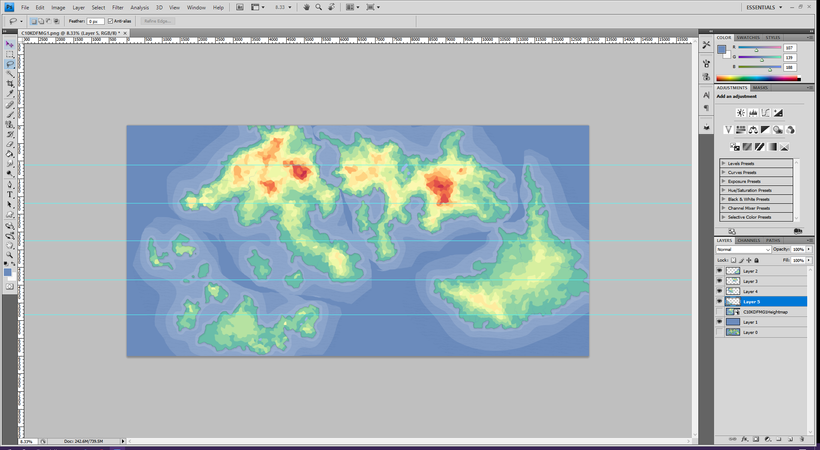
From there I mostly just move things around, though I do rotate and shrink the eastern continent in the northern hemisphere:
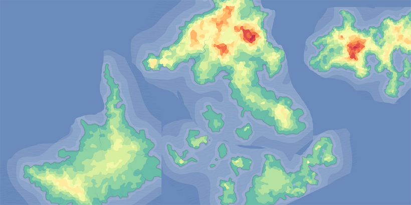
Now, the moment of truth. I load the rearrange map up into Azgaar’s magical machine to see what happens. The good news is that it doesn’t break the map:
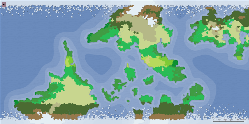
The important stuff is still more or less where I need it, though as I look at it I decide I don’t really like the island placement. I think I need to move those around a bit. Before I start trying to add mountains for the coffee and spreading out the grassland around Khezvaros, I’m going to play around with my photoshop map a little more. Once I’ve got it looking like I want it, I’ll load it back into the Fantasy Map Generator and start fine tuning.

